Route Map - Cuba
This interactive map contains the checkpoints I’ll be stopping at across Cuba (West to East). Each point has a bit about the municipality’s History, Agriculture, Industry, Sites, etc., as well as skating logistics between each stop. Check it out!
Click on a marker to learn a bit about the town.
Click on the image to see a picture of the town, a map to skate there from the last town, and elevations between.
The cumulative distance of all 29 stops is exactly 1600 kms.
Click the brackets in the top right corner to enlarge the map.

Itinerary for Cuba
Gear Weights
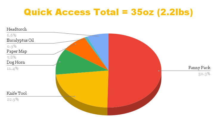
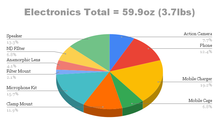
The Charts below layout the weights of the Gear I’ll be carrying across cuba.
Total Weight on Body (17.1lbs or 7.76kgs) is divided into four categories:
Skatepacking Equipment - 8.2lbs
Quick Access - 2.2lbs
Clothes / Worn - 3lbs
Electronics - 3.7lbs
*Note: the weight of my longboard is not included since it is not carried.


Cuba Chronologically
Below is a collection of select videos from Cuba, in order.
For all highlights from the trip follow @jayoskatesworld on Instagram.


